

Introduction
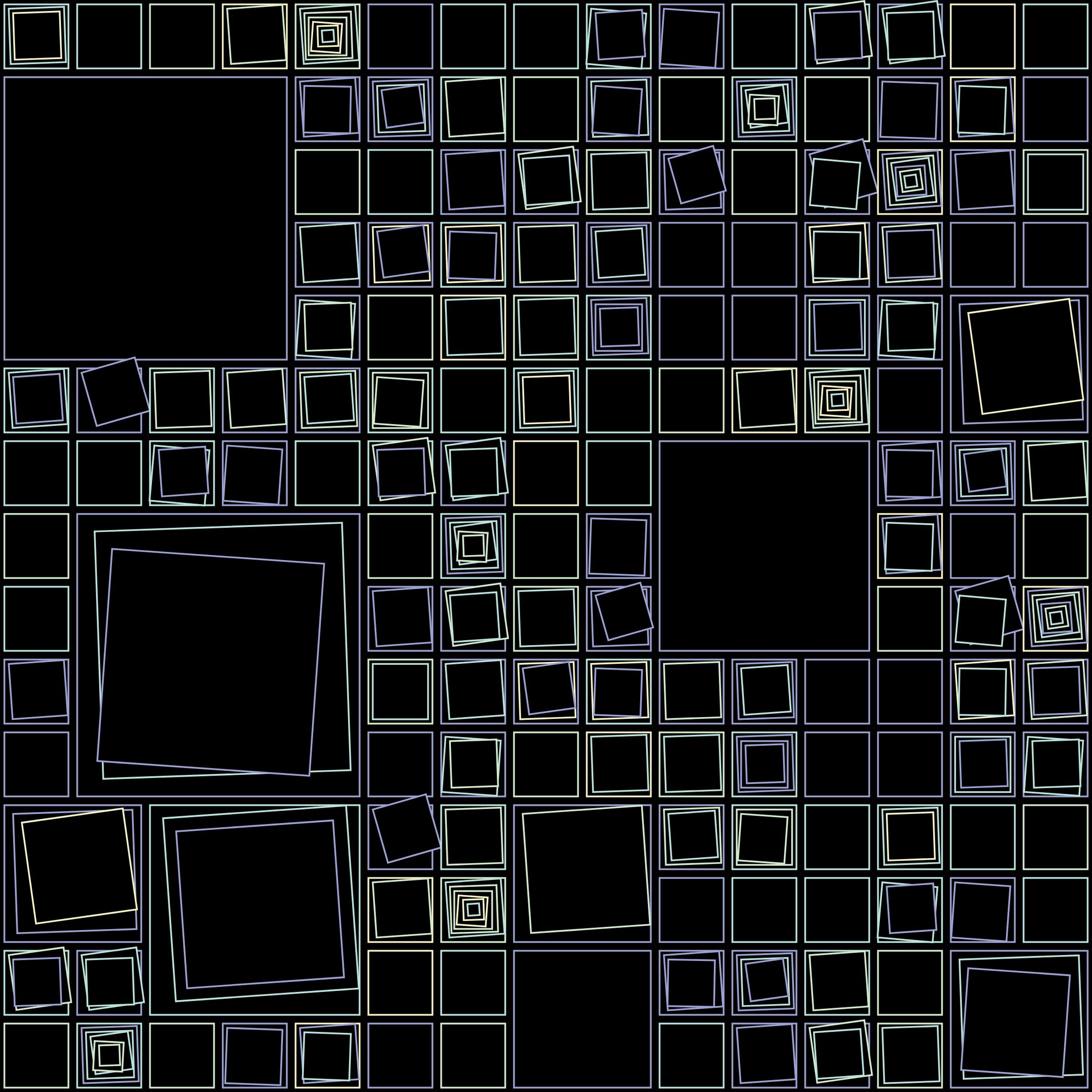
A bird’s-eye view of city blocks varies building height, spacing, rotation and colour through a hash. The artist describes on-chain algorithm storage; the contract has not been independently reproduced here.
 View full image ↗
Preview of Aerial View from its Art Blocks collection page. The series release is dated 2021-03-28; the image was retrieved on 3 October 2026. A still does not reproduce dynamic or interactive execution.
daLenz / Art Blocks · Artwork and image rights remain with their holders; research reference does not assert an open licence.
Source · Aerial View ↗RESEARCH ACCOUNT
A hash determines urban spatial variation
ANTI-AI ARCHIVE · Revised 2026-10-03
Work and historical context
Art Blocks dates Aerial View to 2021-03-28, with an edition field of 1,000 works and attribution to daLenz. This dates the release, not the beginning of every sketch or development process.
Section sources: Aerial View by daLenz
A hash determines urban spatial variation
A bird’s-eye view of city blocks varies building height, spacing, rotation and colour through a hash. The artist describes on-chain algorithm storage; the contract has not been independently reproduced here.
Section sources: Aerial View by daLenz
Viewing the work and its documentation
Read Aerial View through scale: how do local units aggregate into larger spatial relationships? Its aerial appearance is a mode of visual organisation, rather than evidence of a particular city without geographical documentation.
Section sources: Aerial View by daLenz · View work: Aerial View #350
Art-historical significance and comparison
Editorial interpretation: Recognisable urban imagery meets abstract parameters, adding an architectural case beyond a generic category of random geometry.
Section sources: Aerial View by daLenz
Sources for this account
Read work statement and historical date fields; code not independently executed.
Platform token page; work identity and presentation entry checked, without independently reproducing the complete script.
Read Art Blocks release date, edition field and work statement; scripts, contracts and long-term executability not independently audited. Chinese titles are archive renderings. The account and translation are AI-assisted, pending independent human review. Section references identify evidence without claiming independent verification of every historical statement.
Continue with a comparative question
Recognisable urban imagery meets abstract parameters, adding an architectural case beyond a generic category of random geometry.
Dates & version record
Date displayed for this node: 2021-03-28 · Historical date recorded for the source: 2021-03-28
Uses the historical precision supported by the source; 2026-10-03 is the archive addition date.
These dates refer to the historical event or recorded version, not this page’s publication date. The original date precision and unresolved questions are retained.
Original sources & further reading
These links lead to the cited paper, article, institution or conference page. External texts retain their source languages.
Aerial View
https://www.artblocks.io/collection/aerial-view-by-dalenz
Current cited URL
Read Art Blocks release date, edition field and work statement; scripts, contracts and long-term executability not independently audited. Chinese titles are archive renderings.
Provenance, translation & verification
Archive node #130 · Generative-art expansion: artists, works and execution
Research materials & supplement references · 1
Expanded register of generative artists and crypto ecosystems · Read work statement and historical date fields; code not independently executed. · 035
Date as recorded: 2021-03-28
Aerial View by daLenz ↗
Aerial View by daLenz
Archive account based on the listed research materials, not a full translation of the linked work. AI-assisted translation; independent human review pending.
Official material was read within the stated scope; see the source note for reading limits and outstanding checks.
Cite this node
ANTI-AI ARCHIVE. Aerial View: a hash determines urban spatial variation. Art-history node #130. https://salondesrefuses.cn/en/art-history/289
For specific historical claims, also cite the original sources above and include your access date. This account is not a full translation of the linked work.
Adjacent nodes follow chronological order; adjacency does not establish direct influence or causation.